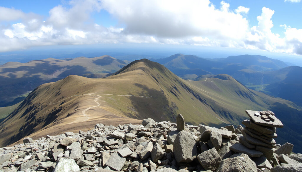
Scafell Pike – Complete Hiking Guide and Route Planning
Scafell Pike rises to 978 metres (3,209 feet) in the western Lake District, the highest mountain in England and a serious objective for walkers of all levels.
Despite an altitude that stops short of the great Scottish peaks, the mountain is best treated as a full day in the hills rather than a casual walk. The shortest and most popular route starts at Wasdale Head, and the National Trust describes the approach in detail on its climbing page. Borrowdale and Seathwaite offer a longer, more scenic alternative via the Corridor Route. Weather, navigation and winter conditions are recurring themes in every guide.
For most walkers, the key decisions come down to route choice, where to stay, how to get there and what gear to carry. The advice below works through each of those in turn, with comparisons to other UK peaks and a close look at spring conditions.
Scafell Pike at a Glance: Height, Routes and Key Facts
England’s highest mountain sits inside the Lake District National Park, and much of the land around it is managed by the National Trust. A few core facts help put the walk into perspective before any route planning begins.
Height
978 m (3,209 ft)
Location
Lake District, Cumbria, England
Main Routes
Corridor Route, Eskdale, Borrowdale
Getting There
Nearest station: Seascale or Ravenglass
The National Trust’s Scafell Pike page urges walkers to plan the route in advance and carry the right equipment. Route guides repeat the same advice in different words, and the key messages are consistent.
- Most accommodation options sit in nearby towns such as Keswick and Wasdale Head, making pre-booking essential during peak season.
- The nearest train station, Seascale, is about 8 miles from the mountain; taxis and onward buses are limited.
- Crampons become necessary from late autumn to early spring when snow and ice are present on the summit.
- Scafell Pike is the shortest of the three national peaks, but its weather and rocky terrain make it a worthy challenge.
- April is a transition month: lower routes may be clear while the summit often still holds snow.
| Fact | Value |
|---|---|
| Elevation | 978 m (3,209 ft) |
| Prominence | 912 m (2,992 ft) |
| County | Cumbria |
| Nearest train station | Seascale (approx. 8 miles) or Ravenglass |
| Typical climbing duration | 4–6 hours via standard routes |
| Best seasons | May–September, when the risk of snow and ice is lowest |
| Main route from the west | Wasdale Head / Lake Head |
| Main route from the east | Borrowdale / Seathwaite via the Corridor Route |
Where to Stay Near Scafell Pike: Hotels, Campsites & Accommodation
Choosing a base depends mostly on which side of the mountain you plan to climb and how much choice you want in services. The options split neatly between a handful of walker-focused settlements.
Best Hotels Near Scafell Pike
Wasdale Head is the closest base for the popular west-side routes, making it the most convenient place to stay when the plan involves an early start. Keswick and Ambleside are also recommended in route guides because they offer more facilities and a wider range of accommodation.
The published sources do not include a full accommodation directory, so the safest approach is to choose Wasdale Head for immediate convenience or Keswick and Ambleside for choice and services. Visit Cumbria’s accommodation guide covers the wider area if you prefer to compare options in one place. For anyone planning to travel with their own sleeping space, a campervan is a practical alternative to hotels and guesthouses; the Volkswagen Crafter – Complete Campervan Conversion Guide explains what a self-built setup involves.
Campsites Near Scafell Pike (Including Wasdale National Trust)
Wasdale Head is home to a National Trust campsite, which serves as the main camping base for the western approaches. One route guide singles out Wasdale Head as the closest and most convenient place to stay for the west-side walks, and the campsite is part of that picture. Availability is the main concern: the site is often fully booked in summer, and the National Trust recommends confirming arrangements in advance.
Wild Camping on Scafell Pike: Rules and Advice
Wild camping is generally tolerated in the Lake District above the wall line, provided walkers follow Leave No Trace principles. The National Trust requests that nobody camps on the summit area itself, so the practical advice is to pitch lower down and leave the summit for walkers during the day.
Accommodation listings are thin in official guides. The common advice from route pages is simple: Wasdale Head for proximity, Keswick or Ambleside for options, and the National Trust campsite at Wasdale Head for camping, with early booking advised in peak season.
How to Get to Scafell Pike: Nearest Train Station & Transport
Most walkers arrive by car, but the mountain is reachable by train for those who plan the final leg carefully. The nearest stations serve different sides of the massif, and onward transport is sparse.
Nearest Train Station to Scafell Pike: Seascale and Alternatives
Seascale is the nearest station to the Wasdale side, roughly 8 miles from the start of the walk at Wasdale Head. Ravenglass serves the Eskdale side of the mountain. Both are small stations, taxis are limited, and connecting buses are infrequent, so train-based plans need extra time built in. Northern Railway’s Scafell Pike page summarises the rail options and station details for the area.
Driving and Parking Near Scafell Pike
Driving directions vary by approach. Coming from the north or west, one guide says to take the A595 toward Gosforth and then follow local roads through Nether Wasdale into Wasdale. From the south, the advice is to leave the M6 at junction 36 and continue via the A590, A5092 and A595. For Borrowdale, drivers are directed to Keswick and then the B5289 into the valley. Live for the Outdoors includes these directions alongside its route description.
The main trailheads are Wasdale Head and Seathwaite. At Wasdale Head, the National Trust car park at Lake Head is the principal parking area and has toilets. Limited parking also exists in the village itself. At Seathwaite, parking is described as being in the farm car park or along the verge, depending on availability and local conditions.
Do You Need Crampons for Scafell Pike? Winter Gear Guide
Crampons are not a year-round requirement, but they become important as soon as snow and ice settle on the upper mountain. The question is less about the date on the calendar and more about conditions at the summit.
When Are Crampons Necessary on Scafell Pike?
Crampons are necessary from late autumn to early spring when snow and ice are present on the summit. Between November and March, Scafell Pike can be very wet or snowy, and one guide warns that winter summits may require an ice axe, crampons and winter experience. The BMC winter conditions report for Scafell Pike is a reliable reference for current snow and ice levels on the mountain.
What Type of Crampons Should You Bring?
The sources do not name a single crampon model or type for Scafell Pike. What they consistently advise is that winter conditions call for crampons, an ice axe and the experience to use both, while shoulder seasons may be managed with microspikes as a minimum. The beginner’s guide from Climb Scafell Pike makes the point that microspikes are not a substitute for crampons when the ground is genuinely icy. For anyone assembling a winter kit, the Down Jacket – UK Brands, Clearance, and Buying Tips article covers the insulating layer that sits underneath the shell.
From November to March, Scafell Pike can shift from a hiking objective to a winter mountaineering one. Sources recommend treating the summit as a place where an ice axe, crampons and winter experience are required, not optional extras.
Crampon necessity depends on current snow and ice at the summit. The safest approach is to check the Met Office Lake District mountain weather forecast within 48 hours of the walk and to carry microspikes at a minimum during shoulder seasons.
Scafell Pike vs Other UK Peaks: Difficulty and Comparison
Scafell Pike is often discussed alongside Snowdon and Ben Nevis as part of the National Three Peaks challenge. The comparisons are useful, but they hide some important differences in terrain.
Scafell Pike vs Snowdon: Height, Routes and Difficulty
Snowdon rises to 1,085 metres, while Scafell Pike reaches 978 metres, making the English mountain the shortest of the three national peaks. Despite the lower altitude, Scafell Pike has a reputation for technical terrain in bad weather, with loose rock near the summit and rapid changes in conditions. The Wasdale Head route is the shortest and most direct ascent, which is why most guides recommend it for first-time visitors.
Scafell Pike vs Ben Nevis: Altitude and Challenge
Ben Nevis is the tallest of the three at 1,345 metres. Scafell Pike is 367 metres shorter, yet its challenge comes from a different source: the Lake District’s changeable weather and the boulder-strewn ground around the summit. Walkers who have completed both often describe Scafell Pike as the harder day relative to its height.
Scafell Pike vs Helvellyn: Which Is More Demanding?
Helvellyn is known for its exposed ridges, particularly Striding Edge, which adds a scrambling element to the ascent. Scafell Pike is generally described as a more straightforward but strenuous climb, with the difficulty coming from the rocky terrain and weather exposure rather than exposed ridgelines. One useful route comparison comes from 10Adventures, which covers the practical differences between the main Lake District ascents.
Scafell Pike in April: Weather, Routes and Seasonal Timeline
April sits on the edge of the winter season on Scafell Pike, and conditions can swing between spring-like valley weather and genuine winter on the summit. The seasonal pattern that follows comes from observations published by ScafellPike.org.uk and other route guides.
- November–March: Winter conditions; crampons and ice axe recommended; shorter daylight; possible closures.
- April: Transitional – snow possible at the summit; lower routes often clear; weather needs careful checking.
- May–September: Best for general hiking; minimal snow; longer days; popular and crowded on weekends.
- October: Milder but wet; snow may return in the late month; fewer crowds.
Weather Conditions on Scafell Pike in April
April to May is often snow-free on the lower slopes, but the weather is less stable than in summer, and fog, rain and high winds may occur. The summit is a different environment from the valley: walkers should expect cold temperatures and the possibility of snow patches well into the month. The Met Office Lake District mountain weather forecast is the standard reference for planning a specific day.
Best Routes for Spring: Eskdale and Alternatives
The most documented routes are the Wasdale Head ascent from the west and the Corridor Route from Borrowdale or Seathwaite. The National Trust Borrowdale route description covers the Corridor Route in detail, including its longer distance and greater navigational demands. The Eskdale approach is listed among the main routes, with Ravenglass as its nearest station, but the available guides do not provide a full route description for Eskdale, so walkers considering it should seek specific guidance before setting out.
The National Trust also documents a Hollow Stones route from the Wasdale car park, described on its Hollow Stones route page as a rough mountain path with loose rocks near the summit and a round trip of roughly five hours. In April, lower sections of all routes tend to be clearer than the summit area.
Preparing for a Scafell Pike Hike in April
April conditions change quickly, so the gear list is essentially a winter list with summer optimism. Boots with good grip, a waterproof jacket, warm insulating layers, map and compass, headtorch, food and at least two litres of water are all recommended by the route guides. An emergency whistle and a fully charged phone round out the kit. Walkers should also expect the summit to feel significantly colder than the car park.
What Is Certain and What Is Uncertain About Scafell Pike?
Some facts about Scafell Pike are well established and appear consistently across every source. Others change with the season, the weather and the availability of facilities.
| What is well established | What depends on conditions |
|---|---|
| Scafell Pike is England’s highest mountain at 978 metres | Exact weather and snow conditions on a given date, which require a forecast check within 48 hours |
| The nearest train station is Seascale, with Ravenglass serving the Eskdale side | Crampon necessity, which depends entirely on current snow and ice at the summit |
| Wasdale Head has a National Trust campsite | Campsite availability, which can be fully booked in summer and needs direct confirmation |
Why Does Scafell Pike Feel Harder Than Its Height Suggests?
At 978 metres, Scafell Pike is lower than Snowdon and Ben Nevis, yet the walking guides treat it with noticeable respect. The reason is a combination of terrain and weather rather than altitude alone.
The upper mountain is rocky, with boulder fields and loose stone that demand concentration underfoot. In poor visibility, navigation becomes genuinely difficult because the summit plateau lacks obvious landmarks. Meanwhile, Lake District weather is famous for changing quickly, and conditions at the summit can differ sharply from those in the valley below. Several guides note that the mountain’s difficulty is less about its height and more about the conditions walkers encounter on the day.
Which Sources Should You Trust for Scafell Pike Planning?
The most authoritative source for Scafell Pike is the National Trust, which manages the mountain and publishes route descriptions for the main ascents from Wasdale, Borrowdale and Hollow Stones. The Met Office provides dedicated mountain weather forecasts that are essential for last-minute planning, and the British Mountaineering Council publishes winter condition reports that directly inform gear decisions.
Visit Cumbria’s accommodation and transport pages are a useful secondary source for the practical side of a trip. For route detail, Ramblers route guidance covers the standard ascent options, and OS Maps’ Scafell Pike guide provides mapping context for navigation planning. UK Climbing weather forums are also mentioned by guides as a place to check recent condition reports from walkers on the hill.
Final Thoughts: Planning Your Scafell Pike Climb
Scafell Pike continues to draw thousands of walkers each year, from first-time summit seekers to experienced hill-goers. What separates a straightforward day from a difficult one is rarely fitness alone; it is the quality of the planning around route choice, accommodation, transport and gear, and the willingness to adapt when the mountain makes its own weather.
Frequently Asked Questions About Scafell Pike
How high is Scafell Pike in feet?
Scafell Pike is 3,209 feet (978 metres) tall. It is the highest mountain in England.
What is the difference between Scafell Pike and Scafell?
Scafell (964 m) is a separate peak adjacent to Scafell Pike. The two are connected by Mickledore col. Scafell Pike is slightly higher.
Can I wild camp on Scafell Pike?
Wild camping is generally tolerated in the Lake District above the wall line, but you must follow the Leave No Trace principles. The National Trust requests no camping on the summit area.
What is the shortest route to Scafell Pike?
The shortest and most popular route begins at Wasdale Head. Most guides allow 5–6 hours for the round trip, with others suggesting 6–8 hours to account for pace, weather and breaks.
How long does it take to climb Scafell Pike?
Typical climbing duration is 4–6 hours via standard routes. The National Trust lists about 5 hours for the round trip from Wasdale via Hollow Stones, while other guides suggest up to 8 hours for a relaxed pace.
Is the Corridor Route harder than the Wasdale route?
The Corridor Route from Borrowdale or Seathwaite is longer and requires better route-finding and stamina. It is often recommended for walkers who want a more varied and dramatic ascent.
What gear is essential for Scafell Pike?
Hiking boots, waterproof jacket, warm layers, map and compass, headtorch, food, water and an emergency whistle are all recommended. Winter conditions may also require an ice axe and crampons.
Do I need a map and compass for Scafell Pike?
Yes. The mountain is rocky and navigation can be difficult in poor visibility, so sources recommend carrying a map and compass and knowing how to use them.
More related posts
 Paula Yates – Biography, Death, and Her Children’s Tragic Story
 Carlos Gu: Strictly Come Dancing Star’s Biography and Personal Life
 Aaron Paul – Net Worth, Wife and His Breaking Bad Journey
 Trevor Nelson – Health Break, Biography and Family
 Anne Ramsey – Biography, Cause of Death, and Iconic Roles
 Oliver Bearman – Age, Height, Net Worth and F1 Career
 Everybody Loves Raymond – Full Cast, Streaming and Reunion Info
 Lufthansa Airlines – Complete Guide to Booking, Business Class & Reviews