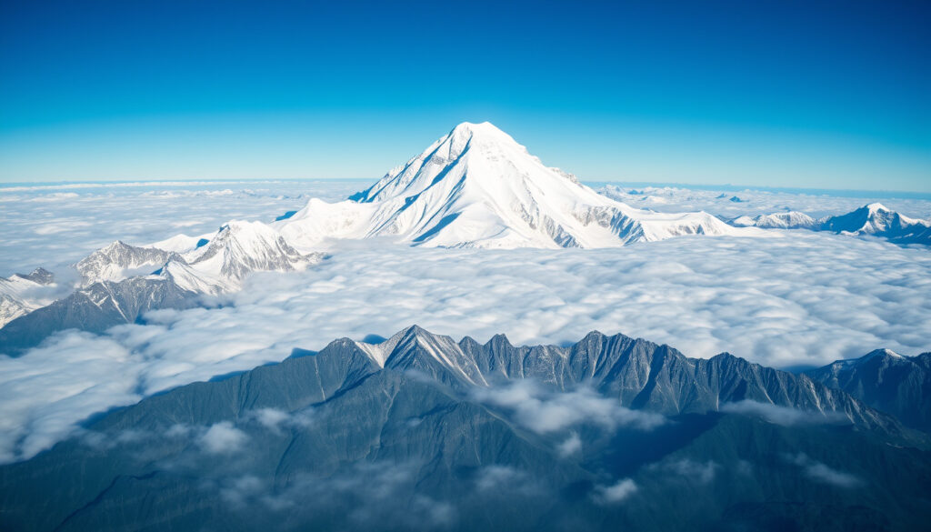
Everest Peak – The World’s Tallest Mountain Explained
Mount Everest, known as Sagarmatha in Nepali and Chomolungma in Tibetan, has long held the title of the highest mountain on Earth above sea level. Rising to an officially agreed height of 8,848.86 meters, the peak sits on the border between Nepal and the Tibet Autonomous Region of China, deep within the Himalayas. The mountain’s stature, location, and the risks associated with climbing it continue to draw global attention, from scientific surveys to commercial expeditions.
The mountain was first identified as the world’s highest peak during the Great Trigonometrical Survey of India in 1856. It was later named after Sir George Everest, a British surveyor, though he personally did not favor the honor. The first successful ascent came on 29 May 1953, when Sir Edmund Hillary and Tenzing Norgay reached the summit. Since then, thousands have followed, but the mountain has also claimed more than 300 lives.
Understanding Everest requires looking beyond a single number. Its height has been revised, its location is shared by two nations, and the experience of climbing it involves extreme physical danger.
How Tall Is Mount Everest?
8,848.86 m (29,031.7 ft) – official 2020 Nepal–China agreement
Mahalangur Himal sub-range of the Himalayas, on the border of China (Tibet) and Nepal
29 May 1953 by Sir Edmund Hillary (NZ) and Tenzing Norgay (Nepal)
Colonel Sir George Everest, British Surveyor General of India
- Mount Everest’s height was officially revised in 2020 to 8,848.86m, ending a long-standing discrepancy between Chinese (8,844.43m) and Nepalese (8,848m) measurements.
- The mountain is shared by two countries: Nepal (south side) and China/Tibet (north side), each requiring separate permits for climbing.
- Despite its extreme altitude, Everest has over 300 recorded deaths and is also a site of enduring mystery (e.g., the ‘Sleeping Beauty’ incidents).
- The name ‘Everest’ was proposed in 1856 by Andrew Waugh, honoring his predecessor George Everest, despite George Everest’s own objections.
Mount Everest at a Glance
| Attribute | Detail |
|---|---|
| Official Elevation (2020) | 8,848.86 m (29,031.7 ft) |
| Old Elevation (Nepal) | 8,848 m (29,029 ft) |
| Location | Himalayas, border of China and Nepal |
| Mountain Range | Mahalangur Himal (Himalayas) |
| First Ascent | 29 May 1953 – Hillary & Tenzing |
| First Solo Ascent | 1980 – Reinhold Messner (no supplemental oxygen) |
| Total Climber Deaths | Over 300 (as of 2024) |
| Common Climbing Season | April–May (pre-monsoon) |
| Named After | Sir George Everest |
Where Is Mount Everest Located?
Mount Everest lies in the Mahalangur Himal sub-range of the Himalayas, on the border between Nepal and the Tibet Autonomous Region of China. Its coordinates are approximately 27°59′N, 86°56′E. The mountain is part of the larger Himalayan range that stretches across five countries.
Which country is Mount Everest in?
The summit and the mountain’s massif are shared by two countries. The southern side falls within Solukhumbu District, Nepal, while the northern side lies in Tingri County, Xigazê, in the Tibet Autonomous Region of China. Both nations grant access via separate permit systems, and climbers must choose a route from either the Nepalese south side or the Tibetan north side.
Everest peak map and location details
The South Base Camp in Nepal sits at about 5,364 m, while the North Base Camp in Tibet is at roughly 5,150–5,200 m, depending on the source. The mountain’s location within the Himalayas places it in a region of extreme weather, tectonic activity, and high altitude, making it one of the most challenging environments on Earth for climbers and researchers alike.
The mountain sits directly on an international border. Climbers must obtain a permit from the country they enter from, and crossing the summit from one side to the other is not permitted without authorization from both governments.
Can You Hike to Everest Peak?
Reaching the summit of Mount Everest is not a hike in the ordinary sense. It is a technical mountaineering expedition that typically takes six to nine weeks, including acclimatization rotations, base camp stays, and the final summit push. The climb is dangerous due to extreme altitude, unpredictable weather, avalanches, crevasses, and the so-called death zone above 8,000 m.
Everest peak hike difficulty
The death zone is the altitude above 8,000 m where the human body cannot fully acclimatize because oxygen levels are too low. Most climbers use supplemental oxygen. The route involves icefalls, steep rock faces, and knife-edge ridges. Even experienced mountaineers face significant risk, and the mountain has recorded over 300 deaths as of 2024.
Climbing seasons and permits
The most common climbing window is April to May, before the monsoon season. Nepal charges a permit fee of $11,000 per person for spring 2024, while China charges about $15,000. Guided expeditions typically include these costs, along with logistics, gear, and support staff.
Anyone considering an Everest expedition should be aware that the mountain has two main base camps: the South Base Camp in Nepal (about 5,364 m) and the North Base Camp in Tibet (about 5,150–5,200 m). Each route requires separate permits, and climbers must be in excellent physical condition with prior high-altitude experience.
Who Was George Everest?
Sir George Everest was a British surveyor and former Surveyor General of India. He served in the Great Trigonometrical Survey of India, which mapped the Indian subcontinent with remarkable precision for its time. Despite his name being attached to the world’s highest peak, George Everest did not name the mountain himself and reportedly did not favor the honor.
The name was proposed in 1856 by Andrew Waugh, who succeeded Everest as Surveyor General. Waugh calculated that Peak XV, as it was known during the survey, was the highest mountain in the world. He recommended naming it after his predecessor. The Royal Geographical Society officially adopted the name Mount Everest in 1865.
In Nepal, the mountain is called Sagarmatha, meaning “Goddess of the Sky,” and in Tibet it is known as Chomolungma, meaning “Mother Goddess of the World.” These names predate the English designation and are still widely used in their respective regions.
George Everest’s own preference was for local names to be used. The decision to name the mountain after a British surveyor has been questioned, particularly in the context of colonial history. Today, both Sagarmatha and Chomolungma are recognized as official names alongside Mount Everest.
Timeline of Key Events in Everest History
- 1856 – Great Trigonometrical Survey of India declares Peak XV (Everest) as the highest peak at 29,002 ft (8,840 m).
- 1865 – Mountain officially named Mount Everest by the Royal Geographical Society.
- 1921 – First British reconnaissance expedition explores the north side.
- 1953 – First successful ascent by Sir Edmund Hillary and Tenzing Norgay.
- 1975 – Junko Tabei becomes the first woman to summit.
- 2014 – Icefall avalanche kills 16 Sherpas; season cancelled.
- 2015 – Nepal earthquake triggers avalanche at Base Camp, killing 22.
- 2020 – Nepal and China jointly announce new official height: 8,848.86 m.
- 2024 – Record number of permits issued (478) by Nepal.
What We Know About Everest’s Height
| Established Information | Information That Remains Unclear |
|---|---|
| The official height is 8,848.86 m (29,031.7 ft) as of the 2020 joint agreement, measured by GPS, gravimetry, and radar from both countries. | Nepal and China previously maintained different official figures: 8,848 m and 8,844.43 m. That discrepancy has been resolved, though older numbers still appear in some references. |
| The official height includes the snow cap; measurements of the underlying rock produce a value roughly a metre lower. | Tectonic uplift and erosion continue to affect the mountain’s elevation. The accepted 2020 figure is intended for current use, with uplift estimated at about 4 mm per year. |
Context – Why Height, Borders, and Commercialization Matter
The 2020 height revision ended a long-standing disagreement between China and Nepal, using modern measurement techniques and a joint survey. The mountain is not only the highest point on Earth but also a geopolitical symbol for both Nepal, which relies on tourism revenue, and China, which asserts territorial claims in the region.
Climbing popularity has surged in recent decades. Thousands have summited, but the increase in traffic has brought issues of overcrowding, environmental damage, and a persistently high death rate. The mountain’s naming after George Everest remains a point of discussion, with ongoing calls to use Sagarmatha or Chomolungma more prominently.
Everest’s status as the highest mountain above sea level is the standard definition used for its record. Other mountains, such as Mauna Kea in Hawaii, are taller when measured from base to peak or from the Earth’s center, but that is a different metric. Everest’s distinction is based on elevation above sea level. Complete list of the world’s tallest mountains offers a useful comparison with other major peaks.
Sources and Key Statements About Everest
Mount Everest is the highest mountain on Earth above sea level.
– Wikipedia
Reaching an elevation of 29,032 feet (8,849 meters), Mount Everest is the highest mountain in the world.
– Britannica
The new official height of Mount Everest is 8,848.86 meters.
– Nepal Survey Department & Chinese Academy of Sciences (2020 joint statement)
Climb the world’s highest peak with the pioneers of guided Everest Expeditions.
Summary – What to Remember About Everest Peak
Mount Everest stands at 8,848.86 meters above sea level, on the border of Nepal and China. It was first climbed in 1953 by Hillary and Tenzing, and has since become the ultimate challenge for mountaineers worldwide. The mountain carries a complex history of exploration, naming, and geopolitical significance. For those considering a climb, the risks are extreme, and proper preparation, permits, and guidance are essential. For a broader view of the world’s highest peaks, see the Complete list of the world’s tallest mountains.
Frequently Asked Questions About Mount Everest
How many people have died on Mount Everest?
As of 2024, over 300 climbers have died on Everest, with the most frequent causes being avalanches, falls, and altitude sickness.
What is the Sleeping Beauty story on Mount Everest?
Francys Arsentiev, known as ‘Sleeping Beauty,’ died on Everest in 1998 after summiting without supplemental oxygen. Her body remained on the mountain for years before being moved.
Do you need a permit to climb Everest?
Yes. Nepal charges $11,000 per person for a spring permit (2024); China charges about $15,000. Guided expeditions often include permit costs.
How long does it take to climb Everest?
The entire expedition typically takes 6-9 weeks, including acclimatization rotations, base camp stays, and the summit push.
What is the death zone on Everest?
The death zone is the altitude above 8,000 m where the body cannot fully acclimatize because oxygen is too low. Most climbers use supplemental oxygen there.
What are the local names for Mount Everest?
In Nepali it is called Sagarmatha, meaning “Goddess of the Sky.” In Tibetan it is called Chomolungma, meaning “Mother Goddess of the World.”
Who was the first woman to summit Everest?
Junko Tabei from Japan became the first woman to reach the summit on 16 May 1975.
What is the official height of Everest in feet?
The official height is 29,031.7 feet, based on the 2020 joint Nepal–China survey that established 8,848.86 meters.
Can you climb Everest without a guide?
It is technically possible but highly discouraged. Most climbers join guided expeditions for safety, logistics, and permit requirements.
More related posts
 Capital Gains Tax UK Calculator – Free 2024/25 CGT Guide
 Reece Shearsmith – Age, Wife, and Career Timeline
 Inbetweeners Will – The Actor, Quotes, and Character Analysis
 Jacob Roberts – Biography, Height, and Soap Opera Career
 Bargain Hunt Presenters – Complete Guide to Current and Former Hosts
 Seth Meyers – Biography, Late Night Show, Wife and Movies
 Che Guevara: Life, Death, and Enduring Legacy — A Fact-Based Guide
 Kate Winslet – Biography, Age, Movies, Husband and Height 2026