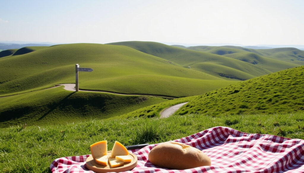
Malvern Hills – Complete Guide to Walks, Maps and Dining
The Malvern Hills rise sharply from the Severn Valley in Worcestershire, forming a 1,050-hectare Area of Outstanding Natural Beauty. The granite ridge, formed over 600 million years ago, is among the oldest rock formations in England and provides a dramatic backdrop for walkers, cyclists and families within easy reach of Birmingham, Hereford and London.
The hills offer more than twenty waymarked routes, ranging from short, accessible strolls near car parks to a challenging full-ridge hike between the Clock Tower area and Hollybush. Planning tools such as the Malvern Hills Trust map and guide, the Visit the Malverns walk finder, and the Route to the Hills PDF help visitors choose the right path for their experience level and time available.
Beyond the ridge, the area combines historic springs, Victorian architecture, Edward Elgar heritage sites, Iron Age hill forts and panoramic viewpoints across up to thirteen counties. Great Malvern town centre provides the most convenient base for accommodation, dining and transport connections.
What are the best things to do in Malvern Hills?
- Malvern Hills is an Area of Outstanding Natural Beauty (AONB) spanning 1,050 hectares in Worcestershire, England.
- The highest point is Worcestershire Beacon at 425 metres (1,394 ft), offering panoramic views of up to 13 counties.
- Over 20 waymarked walking routes exist, from short easy strolls to longer circular hikes.
- The official tourism site (Visit the Malverns) provides a free walk finder with filterable routes.
- Parking is available but limited; early arrival recommended on weekends and bank holidays.
| Fact | Detail |
|---|---|
| Location | Worcestershire, England (near Great Malvern) |
| Highest point | Worcestershire Beacon (425 m / 1,394 ft) |
| Area | 1,050 hectares (2,590 acres) |
| Designation | Area of Outstanding Natural Beauty (AONB) |
| Official tourism site | visitthemalverns.org |
| Nearest railway station | Great Malvern (direct from London, Birmingham, Hereford) |
| Dog-friendly | Yes, but keep on leads near livestock |
Walking routes for all ages and abilities
The official Malvern Hills Trust map and guide covers the full extent of the hills: northern, central and southern sections. It details public paths, access routes, car parks and responsible-use advice. Printed copies are available from the Trust, tourist information centres, cafés, bike shops and attractions.
The Trust’s walking information includes routes for the full ridge, dog walking, easier-access trails and gentler paths suitable for families or wheelchair users. The Malvern Hills National Landscape visitor guide provides downloadable routes and GPX files, along with information on local history, refreshments and attractions.
Malvern Hills walk route map and planning tools
The Visit the Malverns website hosts a filterable walk finder that allows users to search by difficulty, length and location. For those arriving by train, the Route to the Hills PDF links Great Malvern railway station and town centre with Priory Park, Great Malvern Priory, Malvern Museum and access towards the hills.
What are the best circular walks in Malvern Hills?
Top circular walk picks from Visit the Malverns
The hills can be walked end to end between the Clock Tower area at the northern end and Hollybush at the southern end. Hollybush is near the A438 between Ledbury and Tewkesbury.
Other notable circular routes include the North Hill and Worcestershire Beacon outing, a popular central-area walk with extensive views but steep slopes; the heritage-themed Springs and Spouts walk following Malvern’s historic water sources; the Science and Trains walk, an approximately 8-mile circular route exploring Great Malvern station and the town’s role in radar development; the Mathon circular, a nearly 7-mile route through the ancient parish west of the hills; and the Hidden Lake route, a roughly 400-metre path from a car park to a flooded quarry.
How to download a PDF of Malvern Hills circular walks
The Malvern Hills National Landscape visitor guide is available as a PDF download. It includes detailed route descriptions and GPX files for several of the circular walks mentioned above. The guide can be found on the National Landscape’s explore walking page.
Where can I find a detailed map of Malvern Hills?
Official Malvern Hills walk route map
The official Malvern Hills Trust map and guide is the definitive printed resource. It covers the northern, central and southern hills, public paths, access routes, car parks and responsible-use advice. Printed copies can be purchased from the Trust, local tourist information centres, cafés, bike shops and visitor attractions.
Route to the Hills: from Great Malvern station
The Route to the Hills PDF is a dedicated guide designed for visitors travelling by train. It provides a clear walking route from Great Malvern railway station through the town centre, past the Priory, Priory Park and Malvern Museum, and leads walkers towards the eastern slopes of the hills.
What restaurants and accommodation are near Malvern Hills?
Malvern Hills Hotel overview and visitor reviews
Accommodation in the Malvern area is concentrated in Great Malvern, Malvern Link, Malvern Wells, Colwall and nearby villages. Great Malvern is the most practical base for a walking break: it has a railway station, town-centre restaurants and shops, proximity to Priory Park and the eastern slopes, and a wide range of hotels, guesthouses, inns and self-catering properties. Colwall and Malvern Wells offer quieter countryside accommodation with access to western or southern sections of the hills.
Best restaurants near Malvern Hills
Refreshment options include cafés, tea rooms, pubs and food outlets in Great Malvern, the surrounding villages and near popular visitor locations. Practical choices include eating in Great Malvern town centre before or after walking, or using village pubs and cafés along longer countryside routes. Fewer facilities are available directly on the open ridge than in the town and surrounding villages.
Parking at popular hill access points can fill quickly during weekends and bank holidays. Arriving early is advisable. Follow temporary restrictions and signs intended to protect wildlife, heritage sites and visitor safety.
Carry water and snacks for longer walks, particularly the full ridge and 7–8-mile circular routes. The National Landscape guide lists villages and routes with refreshment stops.
Dogs are welcome on the hills, but owners must keep them under close control, particularly near livestock and wildlife. Follow signs and temporary restrictions, especially during sensitive wildlife or grazing periods.
How has Malvern Hills developed as a visitor destination?
- : Malvern Hills known for spring water and holy wells.
- : Malvern Hills Conservators established to protect the hills.
- : Designated as an Area of Outstanding Natural Beauty.
- : Route to the Hills path improved linking Great Malvern station to the hills.
- : Continued popularity; digital walk finder and PDF maps available online.
What information about visiting Malvern Hills is confirmed?
| Established information | Information that remains unclear |
|---|---|
| The highest peak is Worcestershire Beacon at 425 m (confirmed by OS maps and official sources). | The exact number of waymarked walks is not static; official sources reference over 20. |
| Parking is available but limited (confirmed by multiple visitor reviews and the Malvern Hills Trust). | Precise capacity of individual car parks is not publicly disclosed. |
| Dogs are permitted but must be kept under control near livestock and wildlife (confirmed by Malvern Hills AONB guidelines). | Specific seasonal restrictions may apply in certain conservation areas; visitors should follow posted signs. |
| Great Malvern is the nearest railway station with direct services. | Weather conditions can change rapidly on the ridge; no central real-time weather advisories for the hills exist beyond general Met Office forecasts. |
Just as practical guides like Shipping Containers – UK Sizes, Costs and Uses Explained provide definitive specifications, established information about the Malvern Hills helps visitors plan with confidence.
Why is Malvern Hills such a popular destination?
The Malvern Hills are a granite ridge formed over 600 million years ago, making them one of the oldest rock formations in England. Their spring water led to the rise of Malvern as a spa town in the 19th century. Today they attract walkers, cyclists and families within easy reach of major cities. The hills host Iron Age hill forts, diverse wildlife and panoramic viewpoints across Worcestershire and Herefordshire. Beyond walking, visitors can explore Great Malvern Priory, Priory Park, Malvern Museum, Victorian architecture, blue plaques and Edward Elgar heritage sites. Common visitor challenges include limited parking, crowded paths on weekends, and variable weather.
What official sources are available for planning a visit?
A great destination for walkers of all ages and abilities, whether you are interested in a gentle stroll along a tree-lined path or an energetic trek along the ridge.
Visit Birmingham – Malvern Hills listing
The route begins at Great Malvern railway station. From there it’s a steep but short walk towards the town centre and the hills.
Visit the Malverns – Route to the Hills
Search, filter and find walks and walking routes. Malvern Hills walks, Teme Valley Trail walks, and Town walks. Download the leaflet or download the app.
Visit the Malverns – Walk Finder
Planning resources are consolidated on the Malvern Hills AONB official site.
What is the best way to plan a visit to Malvern Hills?
A successful visit starts with choosing the right route for your ability. First-time visitors can download the Malvern Hills circular walks PDF or use the Visit the Malverns Walk Finder to filter by difficulty. Arriving early helps secure parking at busy access points, and the Route to the Hills guide provides a reliable walking path from Great Malvern station. Checking the weather forecast and booking accommodation or dining in advance during peak seasons are practical steps that make the trip smoother. For a perspective on another dramatic landscape shaped over millennia, see the Vesuvius Volcano – Facts, Activity, and Visiting Guide.
Frequently asked questions about visiting Malvern Hills
Is Malvern Hills free to visit?
Yes, the hills are open to the public free of charge. Parking charges apply at some car parks.
How long does it take to walk the full length of Malvern Hills?
The full ridge walk from Chase End Hill to North Hill is about 13 km (8 miles) and takes 4–5 hours.
Can I cycle on Malvern Hills?
Cycling is permitted on bridleways and some tracks, but not on footpaths. Check the official map.
What is the best time of year to visit Malvern Hills?
Spring and autumn offer mild weather and beautiful colours, but the hills are accessible year-round.
Are there toilets and cafes on the hills?
There are public toilets at the Wyche Cutting and a cafe at the Malvern Hills Hotel. More facilities in Malvern town.
Are Malvern Hills walks suitable for children?
Yes, but route choice matters. The main ridgeline has steep and exposed sections. Lower-level and easier-access trails are better for younger children and pushchairs.
Where can I stay near Malvern Hills?
Great Malvern offers the widest choice of hotels, guesthouses and B&Bs, along with convenient access to the hills. Colwall and Malvern Wells offer quieter countryside options.
Is there parking at Malvern Hills?
Yes, there are car parks at key access points including the Clock Tower (north), Great Malvern town centre, and Hollybush (south). Parking can fill quickly on weekends and bank holidays.
More related posts
 Dave Myers – Life, Death and Legacy of the Hairy Bikers Star
 Heathrow Long Stay Parking – Prices, Booking and Transfer Guide
 Lorna Watson – Biography, Career and Personal Life
 Chris Martin Coldplay – Age, Net Worth, and Personal Life
 Max Clifford – Life Crimes and Fall from Power
 Oliver Reed – Biography, Death and His Gladiator Legacy
 Megyn Kelly – Biography, Net Worth, and 2025 Career
 Bob Vylan – Biography, Tour Dates, and Merch Guide 2025